Camden County Under Severe Thunderstorm Watch Until 10 P.M.
Camden County sits under a severe thunderstorm watch until 10 p.m. Thursday after two warnings swept northeastern North Carolina. More warnings are possible inside that window.

This audio narration was generated by Camden Tribune using the open-source Kokoro speech model.
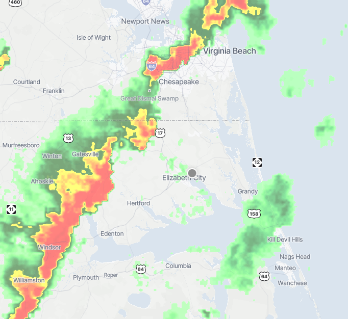
Camden County is under a severe thunderstorm watch from 2:30 p.m. until 10 p.m. Thursday, a seven-and-a-half-hour window covering the evening commute and dinner hour.
Severe Thunderstorm Watch includes Bertie, Camden, Chowan, Currituck, Gates, Hertford, Northampton, Pasquotank and Perquimans counties. The watch area extends north into southeastern Virginia, including Norfolk, Chesapeake, and Suffolk, VA.
A watch is not a warning. It means conditions favor severe storms forming, and the National Weather Service wants residents near a source of updates. A warning means take cover now.
Camden has already drawn two warnings today.
The afternoon so far
The first severe thunderstorm warning ran from 1:27 p.m. to 2:15 p.m. across Camden, Pasquotank, Gates, Chowan, Perquimans and western Currituck.
The Storm Prediction Center issued the watch fifteen minutes later, at 2:30 p.m., a signal that forecasters expected more rounds rather than one passing line.
They were right. A second warning followed and ran until 4 p.m., adding Bertie and Hertford counties plus Chesapeake and Suffolk, with 60 mph wind gusts and penny-size hail. Radar tracked that line from near Roduco in Gates County to near Roxobel in Bertie County, moving northeast at 30 mph.
What happens next
Both warnings have expired. The watch has not, and new warnings can be issued for Camden County any time before 10 p.m.
Radar showed storms still west and southwest of Elizabeth City when the second warning lapsed, with more cells building over Chesapeake and Virginia Beach.
No injuries or damage had been confirmed in Camden County as of 4:30 p.m. The Tribune has not yet reached Camden County Emergency Management.
Drivers on U.S. 158 and N.C. 343 should expect standing water and reduced visibility in the heaviest cells. Treat any downed line as live and report it to the utility.
Written by
Continue following this story
More Breaking News coverage
Water main leak closes Barlowe Street, disrupts U.S. 64 traffic near Manteo Elementary
A water main leak near Manteo Elementary has closed Barlowe Street and affected U.S. 64 traffic as crews make emergency repairs.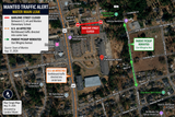
Currituck calls special meeting to seek ferry-toll waiver for local vehicles
Currituck commissioners have scheduled a special meeting on Knotts Island to consider asking the state to waive ferry tolls and fees for locally registered vehicles. The meeting comes 30 minutes before NCDOT’s public tolling session begins.
Bobby Hanig resigns from N.C. Senate, leaving northeastern District 1 vacant
Bobby Hanig has resigned from the North Carolina Senate, leaving the 10-county District 1 seat vacant. The Currituck Republican represented Camden, Currituck, Dare, and seven other northeastern counties.
B&M schedules mining-permit meeting; Camden says no application is on file
B&M’s September 23 meeting concerns a proposed mining permit at 399 Ponderosa Drive. Camden says no application is on file; attendance questions remain.
Sawyer Says South Mills Development Could ‘Outrun’ Sewer Plant as Moratorium Nears End
South Mills wastewater averaged about 25% of stated capacity in July, while Camden says proposed development will require substantially more treatment capacity.
Camden Board Backs Posting Delinquent Taxpayer Names on Social Media for ‘Extra Pressure’
Camden commissioners backed posting delinquent-tax information on county social media after the county manager said broader exposure could add “a little extra pressure” to pay.